


|
|
|
During the last years, activities related to Wind Energy are going through a substantial development. In the course of exploiting wind energy, most of the windy sites in flat or smooth terrains have been covered. As a result, wind park installations will inevitably have to move to areas of more complex topography where the operational conditions are not so favourable.
In terms of the wind potential estimation simple models are in almost exclusive use. However, they often fail to give good predictions especially in complex terrains. In such cases more detailed models such as Navier-Stokes models have been proposed. Navier-Stokes solvers have high computational cost so their numerical behaviour should be studied when restrictions regarding the computer resources are set.
 To better understand the flow mechanisms over complex terrains
To determine the confidence limits of viscous simulation models
and to provide guidelines regarding their usage for siting
One of the major difficulties encountered when Navier-Stokes methods are applied to siting is the imposition of appropriate boundary conditions. Especially in complex terrains the irregularities of the topography extend to a large region, so inflow data are almost impossible to guess.
The difficulty in imposing appropriate boundary conditions on really complex terrains was handled using a "nesting" procedure. According to this, calculations start from a wide region and then focus on the region of interest. In this way, the influence of the surrounding topography, which plays an important role in the shaping of the wind profile and consequently in the determination of the boundary conditions, is taken into account.
Another significant difficulty is the high computational cost due to the large grid sizes used in order to get satisfying predictions. A compromise between reliable results and grid size was sought in order to hold the computational cost reasonable.
In order to assess the whole procedure, a simple case, the Askervein in U.K. was examined. The terrain was extended all around its borders. The grid density was chosen as a compromise between reliable predictions and computational cost:
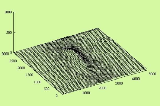
The Askervein hill - Extended domain
The variation of the mean velocity along an intersection which passes through the top of the hill is presented below:
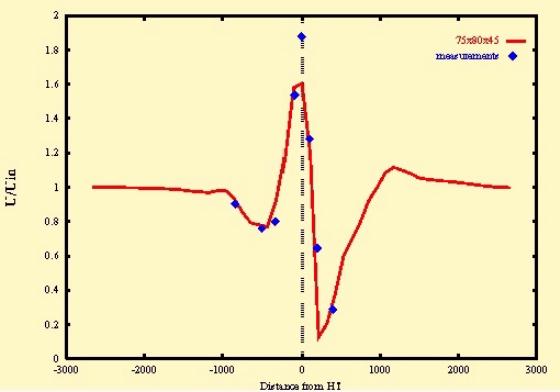
Variation of the normalized velocity
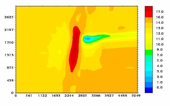
Askervein - Mean velocity contours at 40m A.G.L.
As shown above the methodology well predicts the contours of the mean velocity and can also depict the recirculation zones.
The "nesting" procedure was applied in a really complex terrain, the Zartener Becker site in Germany:
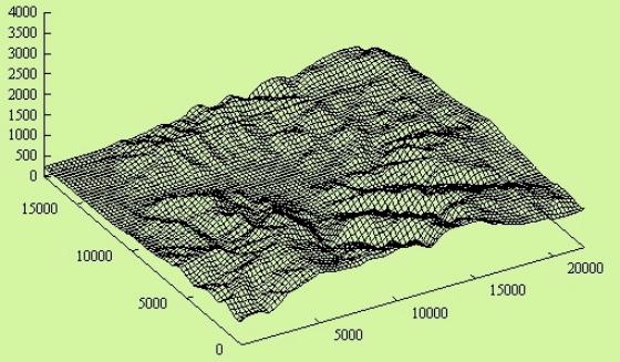
The Zartener Becker site
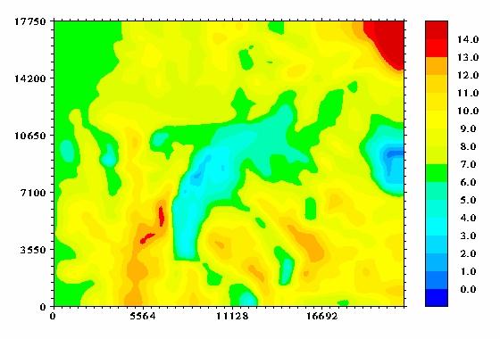
Mean velocity contours at 40m A.G.L. (no nesting)
In the regions located close to the boundaries, there was a substantial difference in the predictions between the direct simulation (when nesting was not used) and the nesting procedure. When nesting was not used the velocities were considerably underestimated (See figures).
Mean velocity contours at 40m A.G.L. (nesting)
Navier-Stokes methodology is capable of predicting the wind
potential over complex terrains.
Nesting procedure can handle the difficulty in imposing appropriate
boundary conditions on really complex terrains.
Satisfying predictions with reasonable computational cost are
possible when a fair compromise on the grid size is made.
Improving Techniques for Statistical and Physical Modelling of Wind Resources in Complex Terrain (JOU2-CT93-0370 CEU).
 |
 |
 |
 |
 |